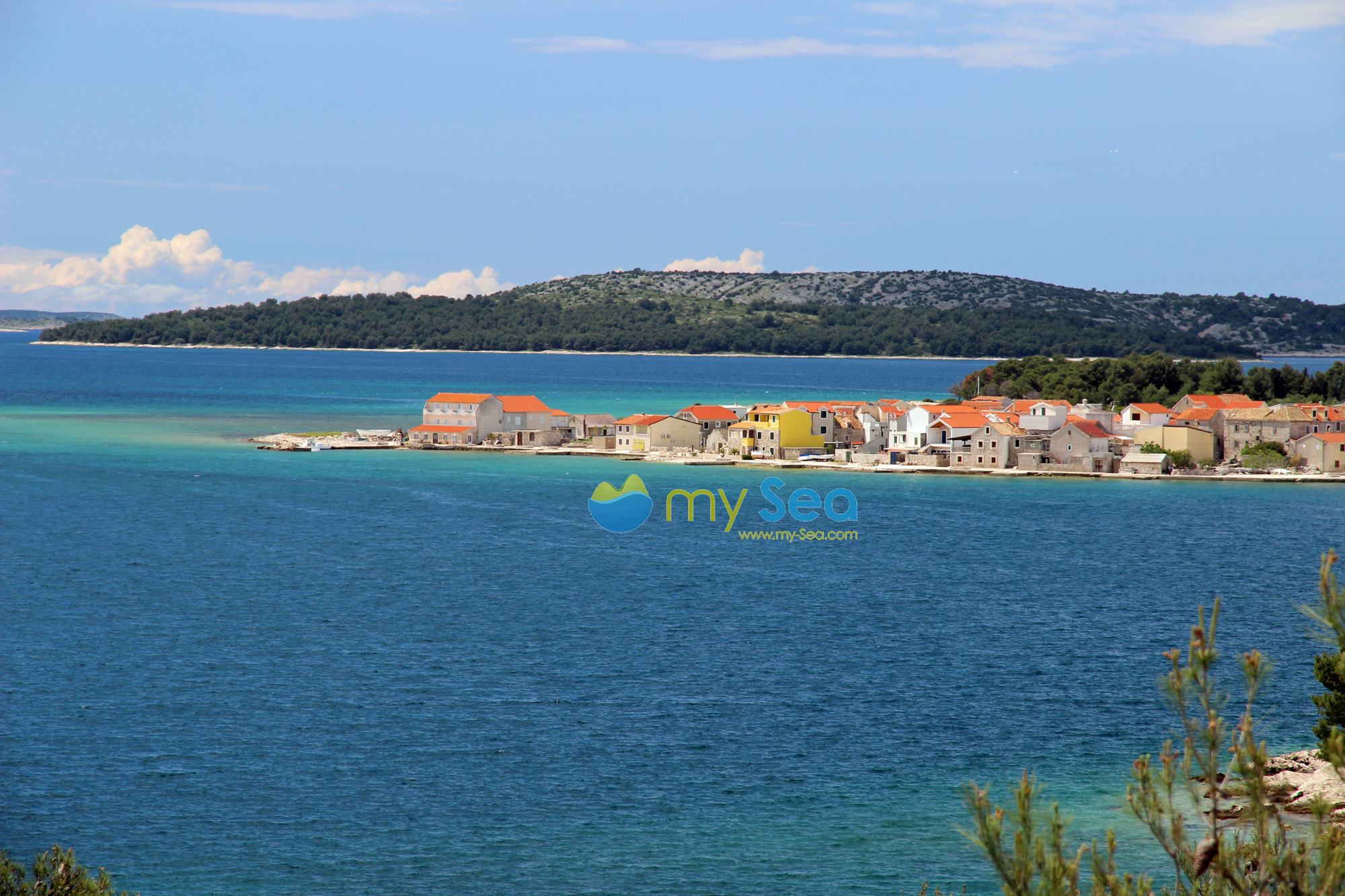
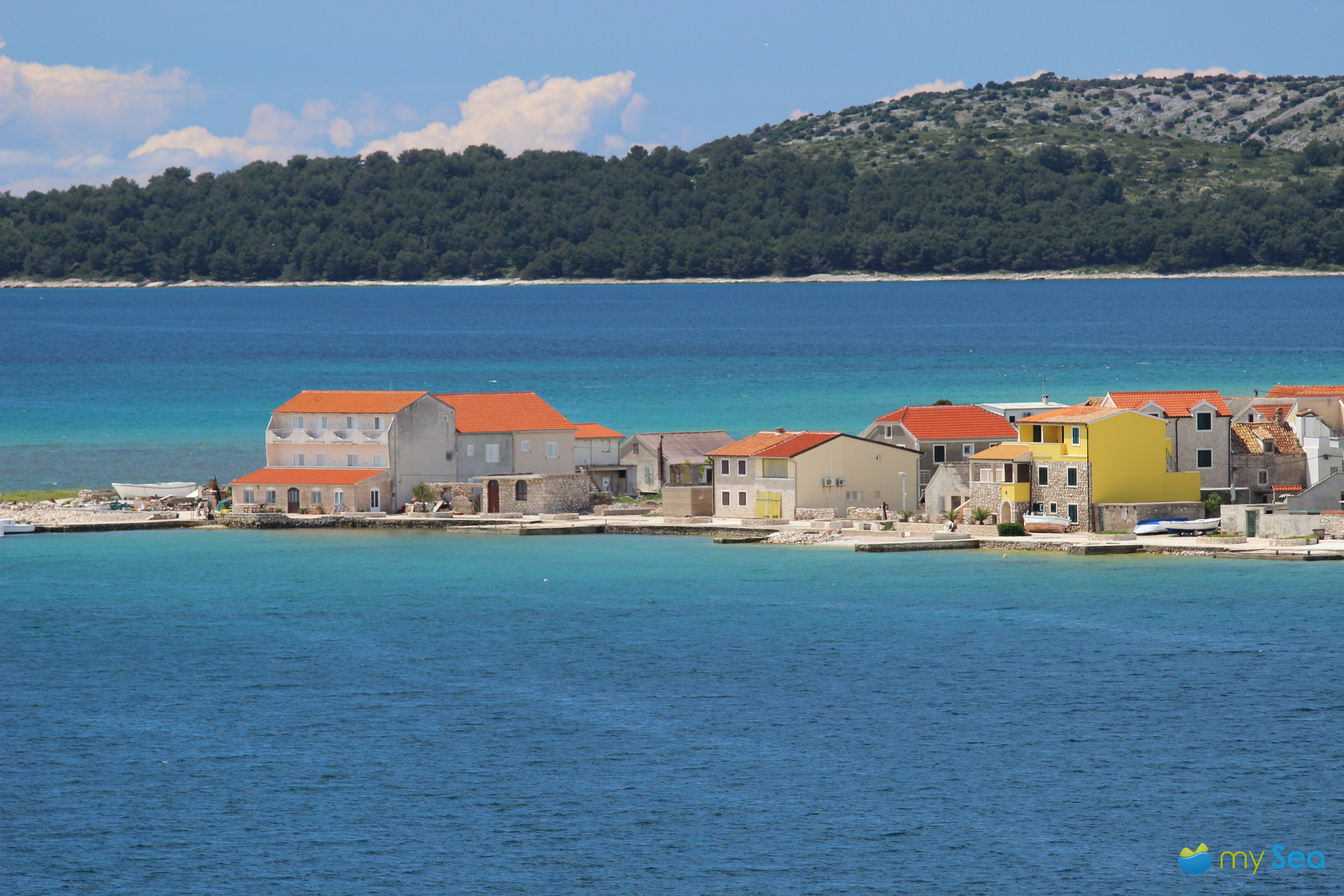
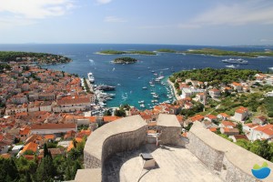
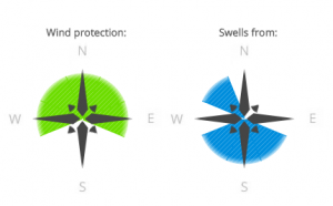
Croatia

Hotel Spongiola

Hotel Spongiola has a small harbour and is located in Krapanj, a small island protruding about 1.5 metres from the sea and only 300 metres away from the mainland. Nikica Jurić, manager of the hotel, comes from a family that has owned the land where the modern hotel has been built for many years. Hotel Spongiola is well-known among water sports enthusiasts mainly for the secure berths but also for the good cuisine.

Krapanj

View on the houses on Krapanj

The approach to the small hotel harbour is only possible from the south as the north of the island is very shallow. Krapanj is thickly forested and very picturesque. The houses on the east coast of the small island have been painted in attractive pastel colours and when the morning sun rises they and the surrounding sea try and outshine each other. A truly magnificent view.

Yachts can moor at Hotel Spongiola’s well-developed jetty, which has mooring berths with water and electricity. The depth of the water at the quay wall is 1.5 -2.5 m and up to 6 m at the jetty. There is a beach next to the berths. Sanitary facilities, a small swimming pool and a sauna are available at the hotel. The restaurant serves a number of regional delicacies in a pleasant atmosphere. Guests can enjoy a glorious view of the sea and the mainland opposite from the terrace. Harbour guests receive a discount on their restaurant bill.


Our aerial video gives an excellent overview of Hotel Spongiola and the berths.


Krapanji is the most densely populated as well as flattest island in Croatia. While there are a lot of houses made of natural stone on the east side, the west side is covered in a dense pine forest. The island is also famous for sponge divers who have been harvesting high-quality sponges since the 18th century. Hotel Spongiola has a small exhibition on this theme in their basement. The hotel also offers diving courses.

Hotel Spongiola

View to the Hotel Spongiola

Anyone who wants to moor at Hotel Spongiola’s small harbour should reserve a berth in advance. It’s easy with mySea and you won’t pay a single kuna more than at the location itself. The exact prices for the berths can be found here.

From Hotel Spongiola you can easily explore the Sibenik archipelago. You can find a good overview about the hotspots, berthing options in good restaurants in our blog about Sibenik archipelago.

The Šibenik Archipelago – the best known secret in the Adriatic Sea (3/3)

Muna, Žirje

Please log in to mySea to follow the links!


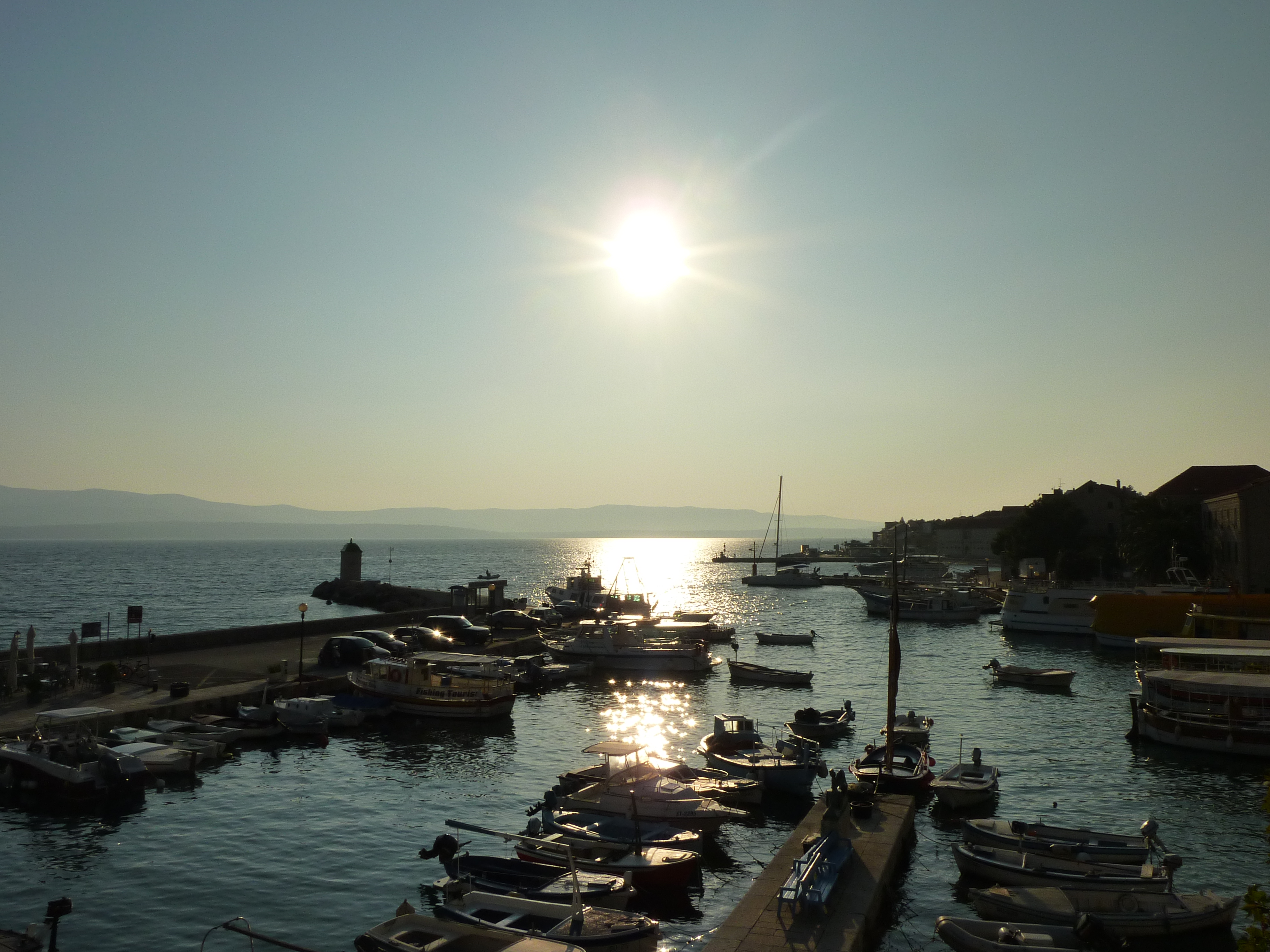
Shortly afterwards we cast off and get to Muna in Žirje quite quickly. Muna is a small place where time seems to have stood still. It is even less crowded and has fewer tourists than other places in the Šibenik archipelago. Even during the season it seems to be in hibernation. Since spring of 2014 the berth situation here has improved dramatically. 20 berths with mooring lines are now available at the eastern quay in Muna harbour. The water at the quay is about 2 to 3 metres deep. The place right at the breakwater has to be kept clear for the ferry, the lifeline of the island. There is a small mini market at the harbour as well as a restaurant and café, which are open from about June to mid-September. Water, electricity and sanitary facilities are not available.
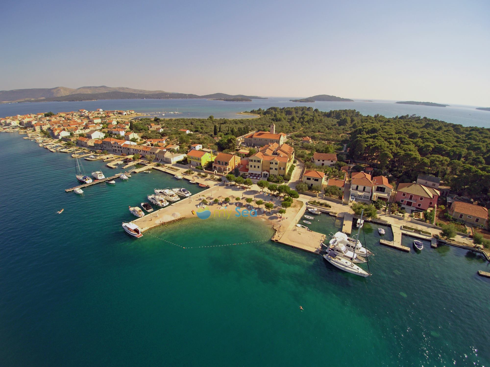
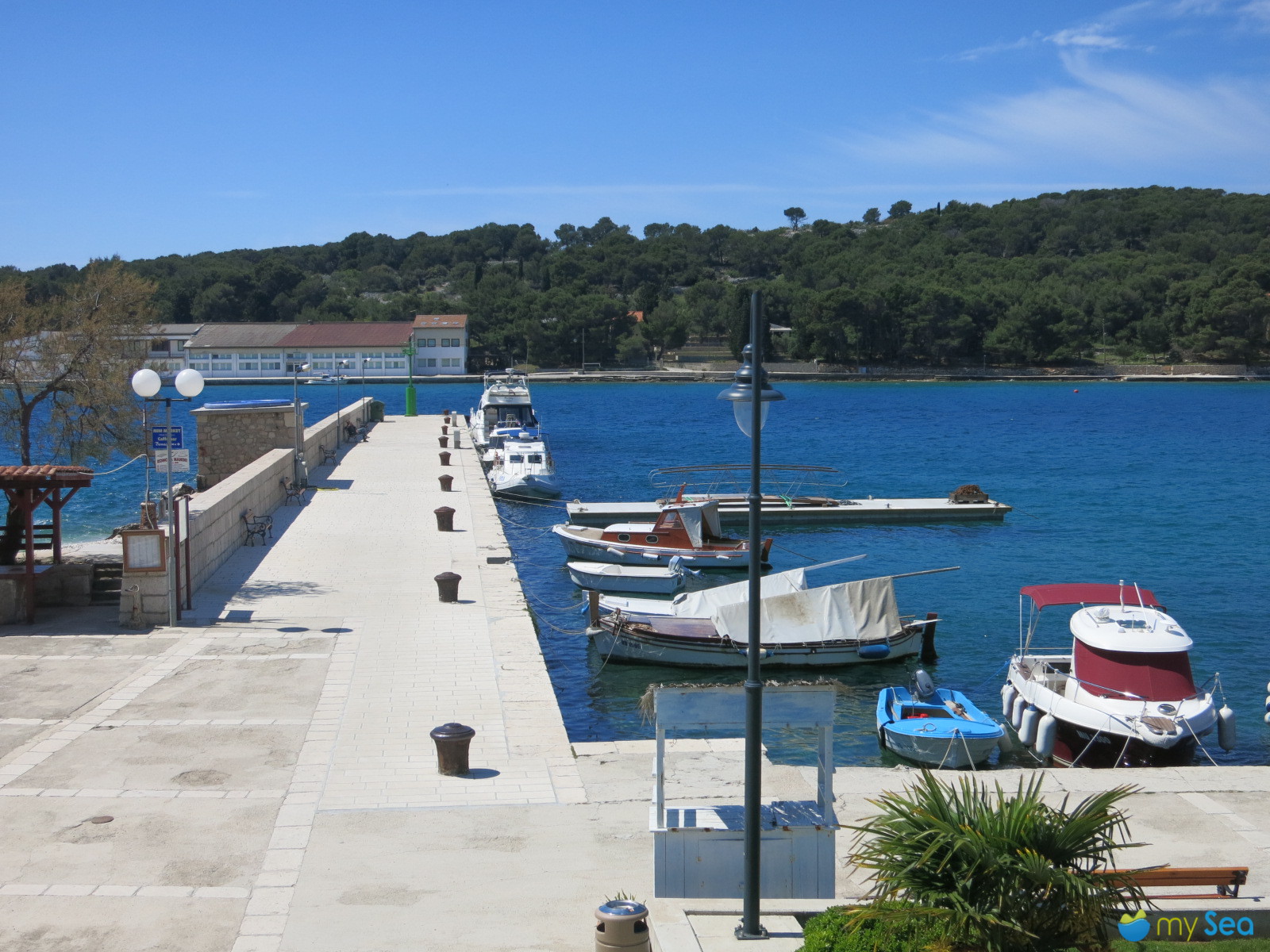
 

Žirje

Ante is already at the quay and helps us moor. His old off-road Suzuki creaks and groans as we drive over the uneven gravel roads. Žirje is the largest island in the Šibenik archipelago and the farthest one from the coast. Tourists often go past the island. Individual tourists mainly come here, such as hikers, mountain bikers and of course sailors. Everything the rest of the 80 inhabitants and tourists need is either grown by the locals or has to be transported over from the mainland by ferry. In winter, life on the island is very lonely and can be difficult at times.
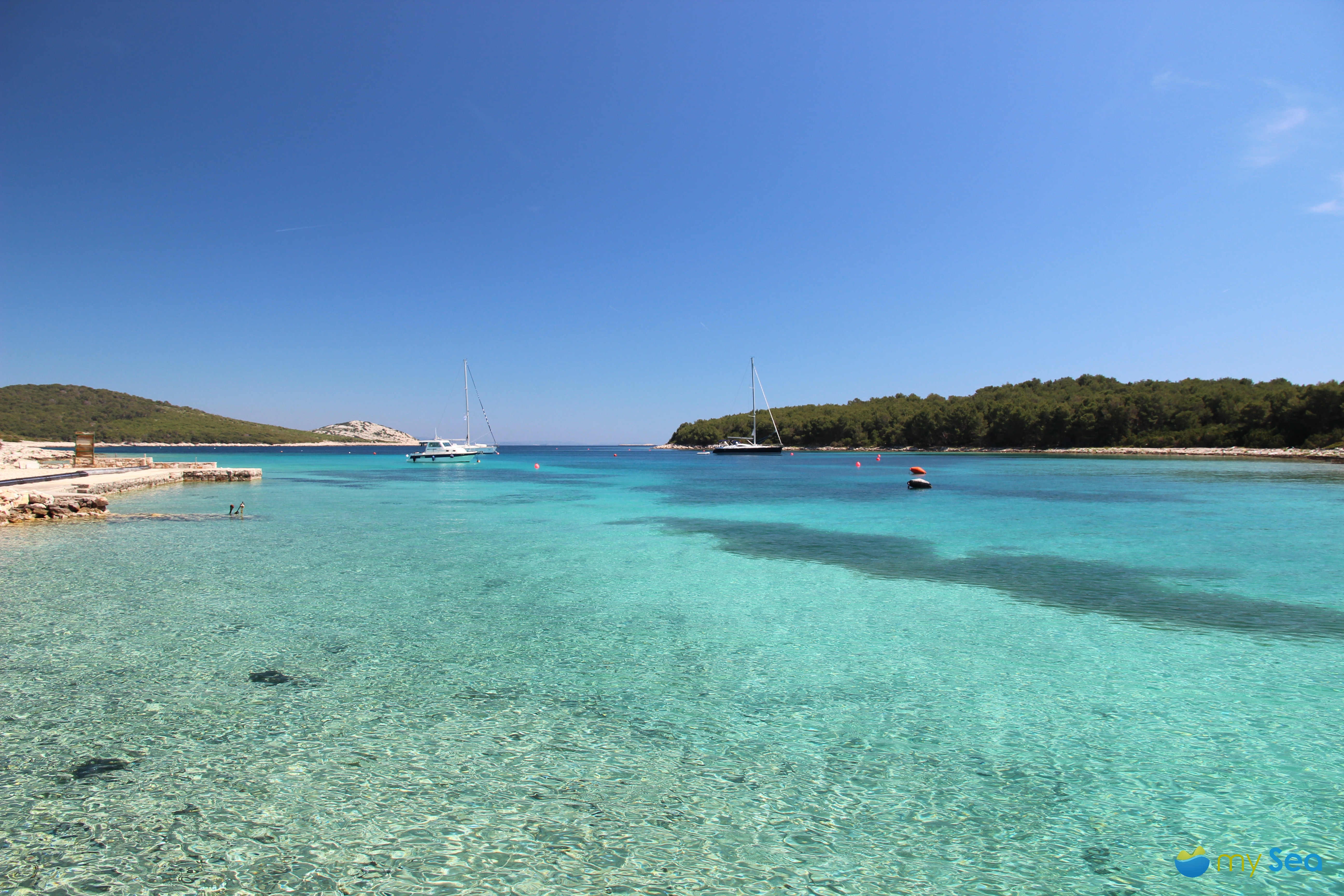
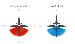
Stupica, Žirje

Koromasna bay in the east of the island is only on very few crews’ itineraries. Several unfinished houses blemish the otherwise green seafront. A few fishing boats are moored behind a jetty. When it is calm, the water is so clear that it is difficult to tell the difference between the surface of the water and the seabed. A restaurant is open during the season in the south-eastern part of the bay. Right in front of it there is a small quay but the depth is not always suitable for yachts.


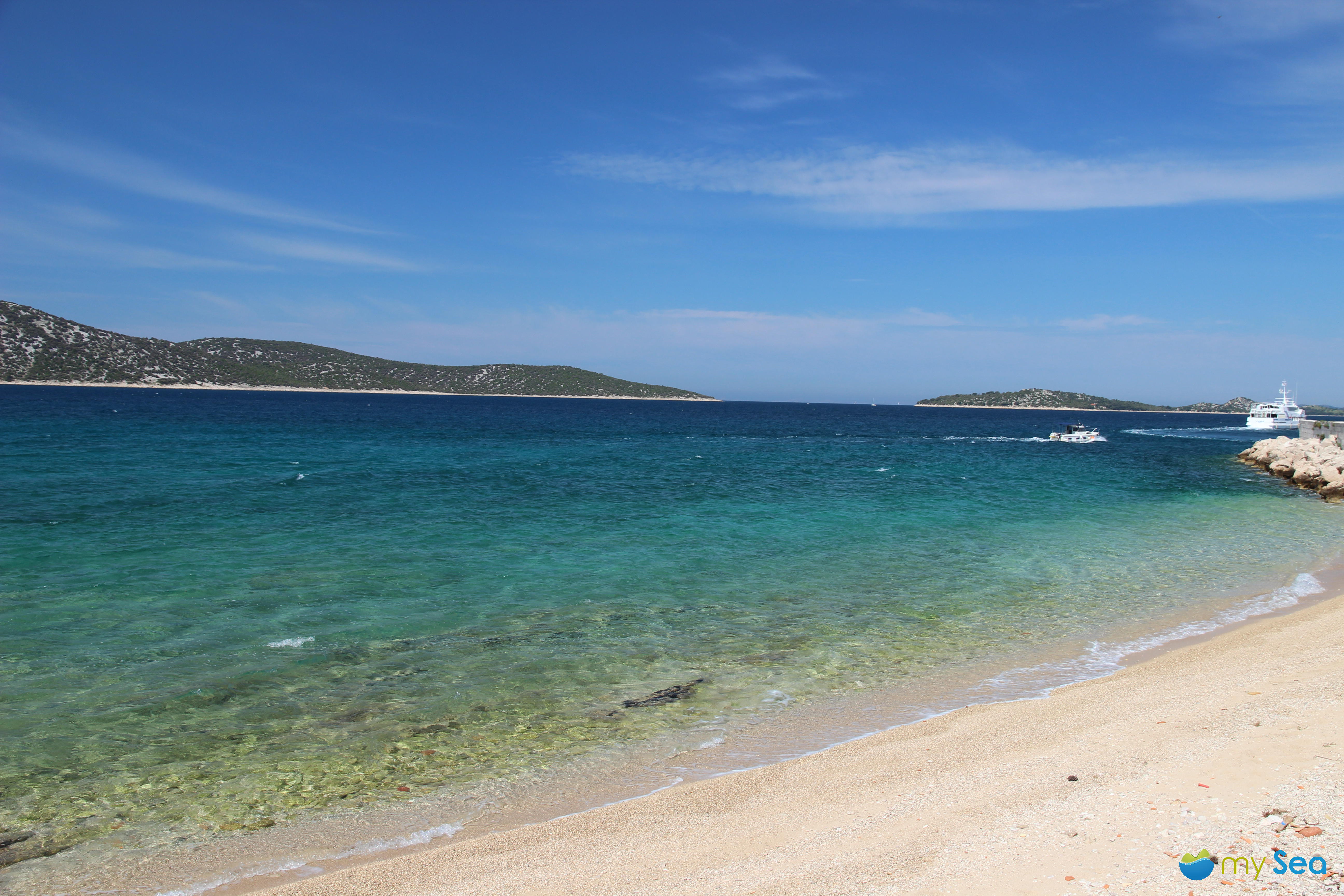
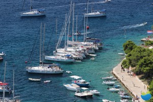
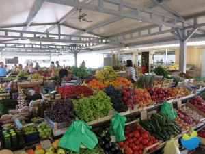
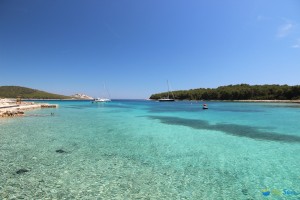
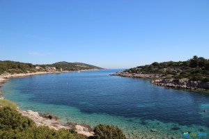
The south-east coast is strongly fragmented and provides a few highlights for yachts such as the Mala and Vela Stupica bays. At the smaller bay located further to the east, boats can anchor freely in the middle of glorious and unspoilt nature. No more offshore islands obstruct the clear view of the broad Adriatic sea. If there was no curvature of the earth, visitors would be able to look right at the Italian boot from here. In Vela Stupica there are two large buoy fields with 40 buoys altogether. The light sandy seabed makes the water appear even clearer than it already is. At the seafront, the cosy Stupica konoba is “hidden” between two shady pine trees. “If you want to dine here in the season, then you can only do so with a reservation,” states Maria, the konoba manager. There are only a few tables in the well-kept grounds, mass dining does not exist here. Just fish and meat are served here as well as vegetables from the island. But only what is available at the moment.


Many tourists stay at the bay for at least a few days to enjoy the peace and quiet. Should anyone need some exercise, then they can go for a walk on the Gradina mountain. There are visible remains of the Byzantine fortress dating from the 6th century. The view is also spectacular. You will need to wear sturdy shoes for the walk. Ante naturally knows all of the trails on the island. He gets hold of a stick and keeps weaving it in and out the entire time in front of him. Spiders have spun their webs between the bushes and are waiting patiently for prey. Ante clears the path for us with the stick, making sure we don’t become the creepy-crawlies prey.
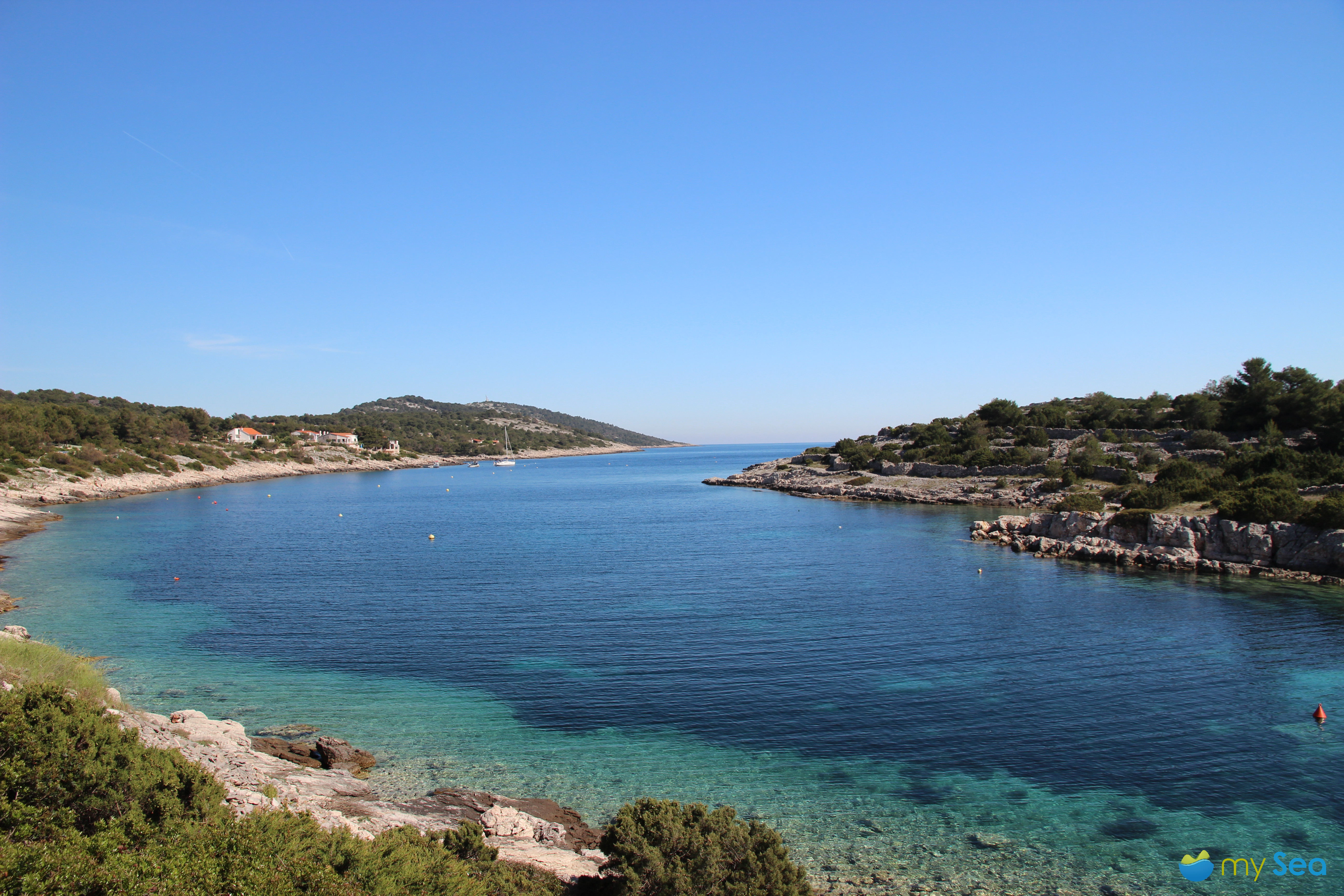
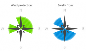
 

Tratinska, Žirje

On the western side of Žirjes, Tratinska bay cuts far into the shore and provides perfect shelter from the Bora. The deeper you sail into the bay, the better the protection. 22 buoys are available here in the season. The Tratinska konoba is located at the northern seafront and is run by a young couple. The konoba also has a few apartments with a swimming pool. This is also the home base of the Austrian Yachting Sports Association (YSVÖ) and a diving centre.

Ante promises to show us one more very special highlight. As we do not have a lot of time left, we get into the rickety Suzuki. The road takes us past Tratinska bay, uphill all the way. In former times the Yugoslav army used to have an observation post on the mountain crest. It quickly becomes obvious as to why. There is no other place in the area providing a better panoramic view than up here. To the north you can see the scattered islands of the Kornati, to the east you overlook the entire Šibenik archipelago, Murter and the town of Šibenik. Towards the south the outline of Vis appears and on clear days you can see Italy to the west. An old concrete bunker framed by a handrail serves as an observation platform. There are small signs on the handrail with the names and distances of places. Towards the south-east we discover a sign but this place is not visible from the platform: Perth, Australia, 13,109 km away.
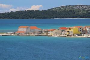
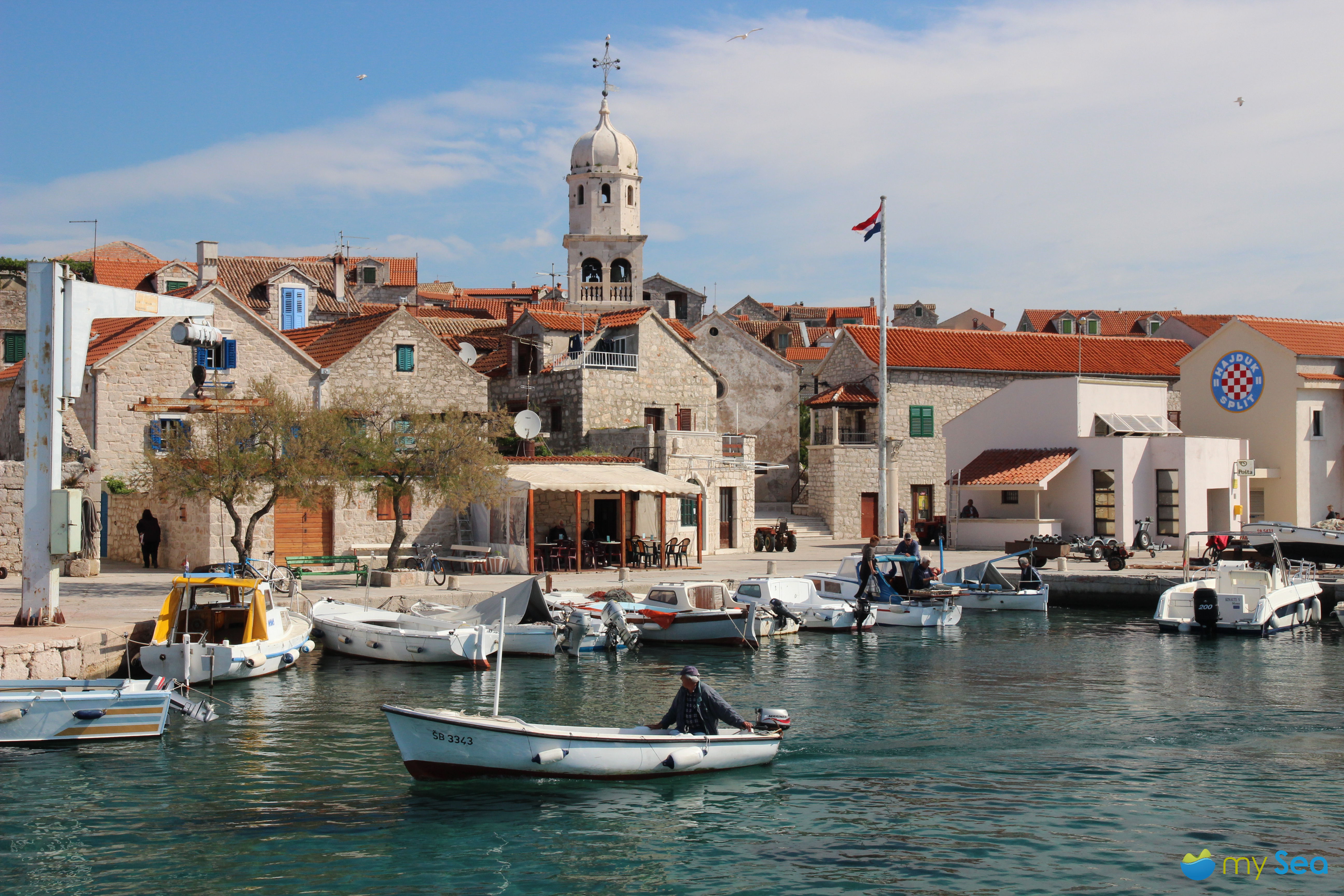
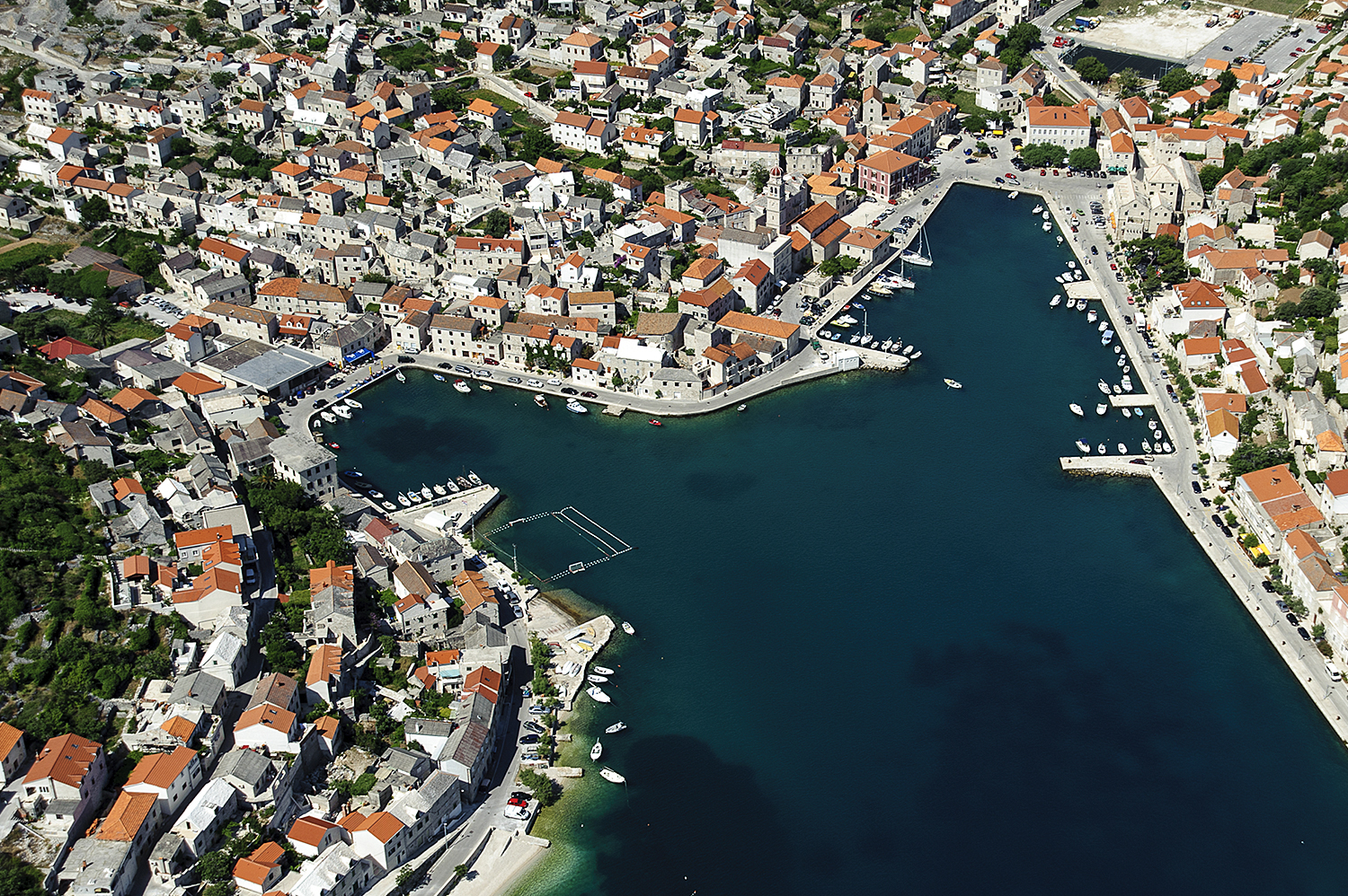
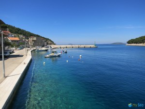
 

Krapanj

On the way back we pay a visit to Krapanj, the most densely populated island in Croatia. The island is barely 1.5 m above sea level and is only 300 m from Brodarica opposite on the mainland. The approach is only possible from the south as it is very shallow in the north of the island. Krapanj is a popular photo motif. If you go past the bridge behind Brodarica, you will get to a small parking area from where you will have an unobstructed view of Krapanj. In the sunlight it looks as though the houses and the surrounding sea are shining. A beautiful picturesque view.

The harbour can only be used by local yachts, visitors cannot moor here. However, they are welcome at the well-developed jetty at Hotel Spongiola where berths, water and electricity are provided. There is a small beach right next to it. Sanitary facilities are available in the hotel. On the mainland opposite, the well-known restaurant Zlatnaribica has built a jetty where you can only moor if you also eat at the restaurant. The restaurant is especially renowned for its fresh wild fish and seafood for which it has received various awards and prizes.

We came upon many more bays, anchorages, small jetties, restaurants and lovely people on our discovery tour through the Šibenik archipelago. The people in the region all seemed to be relaxed, it is less hectic than elsewhere. And this is probably also this region’s secret. The region is ideal for nature lovers and for people who find it more important to enjoy and savour life rather than experience everything at a fast pace. If you have not been to this region yet, make sure you bring plenty of time to explore the most beautiful areas -Šibenik is the ideal starting point.


The Sibenik archipelago is also a beautiful destination for yacht charter and sailing holidays. Besides NCP and Mare also Yachting 2000 offers well-kept sailing yachts and catamarans. Charter reviews of Yachting 2000 can be found at Euminia – the leading review system for chartered yachts.

Have you already read part 1 & 2?


Find out more on mySea.

The Šibenik Archipelago – the best known secret in the Adriatic Sea (1/3)

Everyone’s heard of Kvarner, the Kornati, Krka! But what about Potkučina, Prvić or Zirje? If you were to ask a skipper about their preferred destinations in the Adriatic coast, the Šibenik archipelago will hardly get a mention, and if it does, then at the most as a stopover on the way to Skradin. Most charter guests also prefer to start somewhere between Zadar and Murter or Trogir and Split. Even though Šibenik is centrally located in between the international airports of Split (about 60 km) and Zadar (about 75 km) and the motorway exit is only a few kilometres away from the harbour and marina, Šibenik was never able to establish itself as a tourist destination unlike its popular neighbours.  


Please log in to mySea to follow the links!


But why is that? Is bad marketing to blame or a lack of infrastructure or less attractive destinations? It’s true that Mandalina Marina is the only marina and the harbours also have expansion potential. Equally true is that the islands are abundant in beautiful bays and sheltered anchorages. Nature lovers, discoverers and keen swimmers will get their money’s worth here, too.


Šibenik with its 43,000 inhabitants is more urban than other places on the Adriatic coast. The reason for this is not least because Šibenik never had to push tourism like other places that mainly live from tourism. This town on the river Krka still has an intact industry today and many people work in the energy sector.

Prvić harbour

They simply aren’t dependent on tourism as much as the well-known towns and villages nearby. So it’s hardly surprising that you will see less tourists in Šibenik than e.g. in the neighbouring town of Vodice, which is more developed for tourism. There is not much for visitors to see, only industrial plants and harbour installations, apart from when they arrive and depart. Then they get to see especially the magnificent buildings built during the old Austrian empire, the Venetian fortifications, palaces, churches as well as cafés and restaurants in historic buildings. People who are interested in culture but while holidaying still do not want to miss out on any urban dynamism, they should visit Šibenik, also a UNESCO World Heritage site. And not only as a quick side trip.

We set sail at the beginning of May with a professional skipper from Šibenik to explore the archipelago. We wanted to discover harbours, bays and anchorages in the archipelago. Of course, we also wanted to explore the culinary side. We start at the D-Marin Mandalina in Šibenik with Prvić as our destination.

Prvić Šepurine

The entrance to St. Anthony’s Channel has red and green markings on both sides and is completely hassle-free even in the dark. Signalling equipment has been installed for ships weighing at least 50 tonnes. We pass quickly through the channel, which is between 150 and 220 m wide, in spite of the speed limit of 10 knots. The cliffs on the south side protrude slightly more steeply but are just as green as the cliffs on the opposite side. At the western end of the channel there is a small anchorage and an imposing fortress in front of it. At St. Nicholas fortress, dating from the 15 th century, visitors can moor at a small jetty. However, there is only space here for one single yacht. And the swell generated by the incoming and outgoing ships is quite significant.

But we want to keep going. The engines of our Phantom 40 push powerfully through the glassy ocean towards the north-west to Prvić. It is the closest island to the mainland and a worthwhile destination. Both places on the island – Šepurine in the north-west and Prvić Luka in the south – are a clear contrast to touristy Vodice or urban Šibenik. It is a lot quieter and more relaxed here. The 500 inhabitants are mainly among themselves now in the pre-season. Only a few yachts manage to find their way here. We first call at Prvić Šepurine, the main town on the island. Šepurine is a quiet place, off the beaten mass tourist track. The church of St. Mary of the Assumption towers over the village and its 400 inhabitants, many pretty stone cottages are clustered around the harbour.

Prvić Šepurine

Now in May, many locals are still busy getting ready for the new season. The final touches are being done on the facades, fishermen are painting their boats and the konoba terraces are being prepared with seats. Even thought the May sun in a cloudless sky is already radiating heat, proclaiming the approaching start of the season, it is not hectic. Not even Maria, the owner of the Bare konoba. She is pruning the small olive trees in front of the entrance to the konoba. And she tells us that it is very difficult in the season to get one of the few berths at the harbour. From June to September the berths are usually taken by noon. Not totally selflessly she adds that sometimes it is possible to reserve a berth at her place. This, of course, also includes a visit to the konoba.


Find out more on mySea.

The mySea team was travelling on a Phantom 40 von NCP and Mare yacht charter. NCP and Mare is member of Euminia, the review system for charter yachts. Euminia displays yacht charter reviews from real boaters.


Don’t miss parts 2 & 3 of this article!

Where to berth in Hvar?

Hvar

If you ask insider about places to be during your Croatia trip, Hvar is mentioned almost all the time. In the small and picturesque town live about 4.000 people and it is located at the south west side of the island Hvar in a sheltered bay. Approaching the island the first thing you will notice is the Spanish fortress of the 13th century high above the city. It takes a sweaty walk of about 20 minutes to get there. Instead you’ll be rewarded with a stunning view over the harbour, the city and the close-by Pakleni islands.


Hvar became quite a hotspot in the last couple of years. Not only Croatian stars are well seen visitors, but also international jetset have spotted the neat city. That is why in Hvar costs are higher than anywhere else in Croatia. That includes anchorage as well as a visit in the several restaurants and bars. Of course there are also good restaurants with more decent prices.


The most beautiful view of the city you’ll get from the sea. Standing on the yacht you’ll get an impressive view of the water front lined with palm trees and the ancient 700 years old defence walls all up the hill to the fortress Španjol of the 16th century. Above this fortress there is the French, in 1811 built fortress Napoleon. Today it’s used for mobile communication installations. The most important monasteries and churches originate from the bloom of the island during the Venetian governance from 15th to 18th century. Back then the island was a very important trading base in the eastern Adriatic region. Where back in the days the Venetian navy stayed during winter you can see nowadays shiny polished super yachts.


Hvar

The mixture of super yachts, cruisers, sailing yachts, motorboats, rips, dinghies, jet skis, ferries, taxi boats, and SUP’s (Stand Up Paddling) is pretty unique. Motors scream, chains rattle, people laugh. The traffic in the port basin and therefore the swell is remarkable. On some days you can count about 100 yachts in the harbour. And all of them came to enjoy the glamourous flair of the city.


And there’s a lot of flair in Hvar. Straight to the central place with its smooth polished stones there’s one of Europe’s oldest theatres.

Hvar

Today you can visit a small exhibition and the museum in there.

Alongside the central place you will find many different restaurants and bars, inviting to linger. At the end of the central place is the farmers’ market where you can purchase fresh fruit and vegetables, fish and bread. Also there is a larger supermarket in the nearby area.

The problem is to find a berth in Hvar. Following we describe five possible places to berth your yacht.


 Berth possibilities in the harbour of Hvar:


1)    At city quay with mooring-lines, electricity and fresh water. But city quay is mostly completely taken and smaller yachts have hardly a chance to get a free spot. A reservation by phone with suitable extra charge will help.

Windrosen Hafen Hvar

2)    In the western part of the harbour bay you’ll find 6 single buoys where you can moore by rope.

Windrosen Einzelbojen Hvar

3)    There’s another buoy field in the south western part of the bay. Several yachts share one buoy by mooring by bow-line. Also they have to fix their yacht by land-line on the shore. If strong winds come in from north or south the maneuver requires quick coordination of the crew. Both, bow-line and land-line have to be banked quickly.

Windrosen Bojenfeld Hvar

4)    You can anchor in 12-18 meters depth (39-59 ft.) if your anchor chain is long enough and if there’s no wind from the south. If so, you have to leave the place. It’s located in south-western direction of the buoy fields.

Windrosen Ankerplatz Hvar

5)   In the nearby area of the harbour there are several other possibilities to anchor (e.g. Marinkovac) or the ACI-Marina Palmizana on Sv. Klement. Taxi boats leave regularly to Hvar.

Croatia – The Land of a Thousand Islands (3/3)

Today we are going to introduce you to two more Croatian islands. The islands of Krk in Kvarner Bay and Brac off the Central Dalmatian coast. Krk is the largest island in the Adriatic Sea whereas Brac has the highest island point.

Krk

Krk

Krk has a surface area of just over 400 km² and is the largest island in the Adriatic Sea. It lies in Kvarner Bay, SE of Rijeka. The island has been connected to the mainland since 1980. About 1,300 different species of plants grow in Krk, typical trees e.g. include holly oak and downy oak. Many birds inhabit the island and in autumn are joined by a number of migratory birds. But Krk is most famous for its butterflies. Visitors can admire the many different species especially in late spring and summer. Other species of animals are quite rare on the island, the animal population mainly consists of domesticated animals. Yachters will find the many bays and anchorages around the island particularly interesting. The water is clear and some bays slope gently so that they are also suitable for families. Vela Plaza beach in the holiday resort of Baska is especially popular with families. It is often overcrowded in summer. Lots of the smaller bays, however, do not have many visitors even in high summer. There are many beaches perfect for relaxing and wiling the time away. Very popular among sailors in the Marina Punat on Krk.

Brac

KrkBrac is located opposite Split off the Central Dalmatian coast. A visit to the island is virtually a must for sailors. This is completely understandable as the “Golden Horn”, the beach near the town of Bol, is famous well beyond the island’s borders and attracts many holidaymakers every year. The beach is a promontory and the peak changes its direction during strong winds, attracting many wind surfers and kite surfers. The coast around the island boasts many larger inlets and bays, which for the most part are suitable for anchoring or mooring. Many not so known anchorages do not get full even in summer, and therefore are quiet and ideal for relaxing. But Brac is also the island of stones. The Romans used the famous white limestone to build their temples and rumour has it that this stone was even used to build the White House in Washington. Limestone rocks can be found in many fields, stacked up to form “gomelas”.