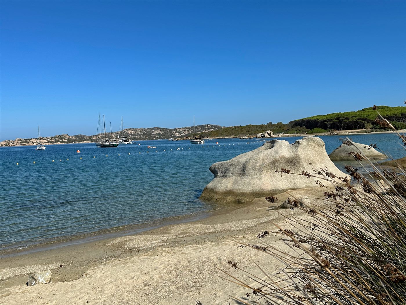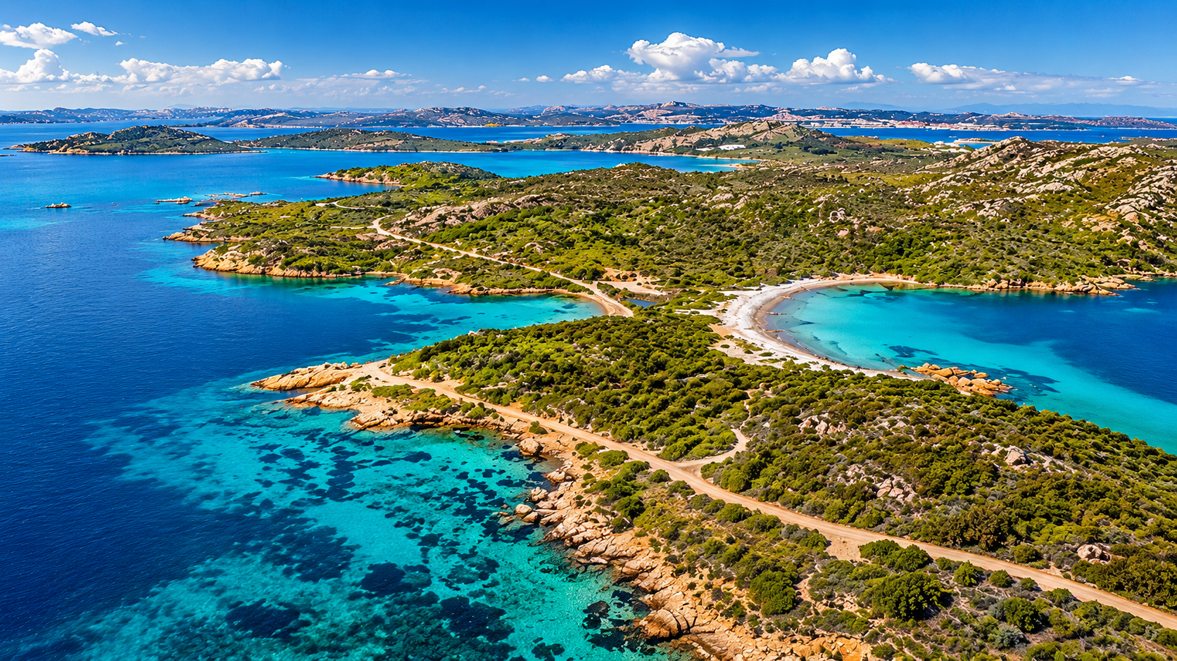
La Maddalena is not a place to tick off quickly. Between Caprera, Spargi, Budelli, Razzoli and Santa Maria, the light, granite, sand and water combine in a way that feels unmistakably Mediterranean and, at times, almost unreal.
In 2026, the archipelago still rewards visiting crews. It simply asks for a little more preparation than an ordinary swim stop. The relaxed approach is not to treat the rules as an obstacle, but as part of good cruising practice: permit before entering, Posidonia before anchoring, mooring options before late afternoon and Cala Coticcio as a separate shore-access plan.
Quick crew briefing
- Arrange the park permit before entering the park waters.
- Keep anchors and chain clear of Posidonia and other sensitive seabeds.
- Plan moorings and alternatives early, especially in high season.
- Treat Cala Coticcio and Cala Brigantina as separate shore-access topics.
- Check current park maps, Ordinanza 33/2026 and local notices before departure.
What matters in 2026
For the 2026 and 2027 summer seasons, Ordinanza 33/2026 from the La Maddalena Coast Guard sets the current framework for navigation, anchoring, mooring and maritime activities in the archipelago. The seasonal measures apply from 1 June to 30 September each year. Alongside that sit the National Park permit system and the specific access rules for sensitive land areas such as Cala Coticcio and Cala Brigantina.
For a crew, the planning questions are straightforward:
- Do we have the right park permit before entering?
- Are we anchoring on sand or mud, not on Posidonia or sensitive habitats?
- Are we outside no-anchoring corridors, bathing zones and regulated mooring areas?
- Are shore visits, especially Cala Coticcio and Cala Brigantina, planned separately from the anchorage?
Get those four points right and La Maddalena becomes far easier to enjoy.
Permits: deal with them before entering
The National Park uses authorisations and tickets for activities inside the protected area. For yachts, the practical message is simple: arrange the permit before using the park waters, not during a control.
The official park information explains that authorisation before entering helps avoid penalties and a surcharge if payment is initiated by control staff. Applications are handled through the park platform and payment through PagoPA. Fees depend on boat length and duration, with daily, weekly and longer options. Sailing yachts receive a discount, and online purchase brings a small additional reduction.
For charter crews, the permit belongs in the same planning folder as weather, route and overnight stops. Leaving Palau, Cannigione or Bonifacio and trying to sort it out underway makes the day less relaxed than it needs to be.
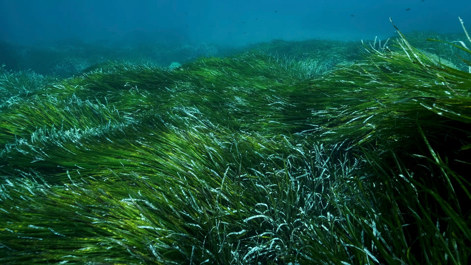
Posidonia comes first
In La Maddalena, water colour alone is not enough. Pale patches are often sand; dark patches may be rock, shadow, seagrass or Posidonia. For anchoring, that distinction matters.
Ordinanza 33/2026 prohibits anchoring on Posidonia oceanica meadows and other sensitive habitats mapped by the park. Anchoring is permitted only on inert seabed, essentially sand or mud, and only where all other local rules, distances, corridors, bathing areas and mooring restrictions allow it.
This is not just a legal detail. Posidonia meadows stabilise the seabed, provide habitat and help keep the water clear. An anchor and chain sweeping through a meadow can cause damage well beyond a single night.
Practical habits help:
- check the seabed before dropping the anchor
- think about the chain’s swing circle, not only the anchor point
- move on if the bottom is mixed or unclear
- avoid using the last dark gap in a crowded bay
- give current official rules more weight than old pilotage notes
Moorings are useful, not a substitute for planning
Moorings and buoy fields reduce pressure on sensitive seabeds and can make some bays easier to use. But regulated mooring areas have their own park rules and plans; anchoring between buoys is not simply a fallback option.
La Maddalena is not a place where every yacht must always take a buoy. Nor is it a place where crews can anchor wherever there is space. The right question is more precise: what is allowed in this exact place, today, for this use?
Arriving late in a popular bay is the classic stress point. In summer, by early evening the ideal combination of free buoy, shelter, space and permitted seabed may no longer exist. A better rhythm is to keep a Plan B ready, separate swim stops from overnight stops and avoid making the day depend on one famous anchorage.
Corridors, bathing areas and local limits
Annex 1 of Ordinanza 33/2026 includes coordinate-defined corridor and safety-respect areas where anchoring is prohibited, including areas around Punta Rossa, Cala Connari, Spiaggia Rosa, Passo degli Asinelli and Santa Maria.
These are not a message that the whole archipelago is closed. They are specific areas designed for safety, traffic separation, rescue access and order in heavily used waters. Crews should check the official annexes, park maps and local markings, especially where excursion boats, swimmers, narrow channels and anchored yachts meet.
Speed also belongs to the same practical picture. Within the relevant coastal area, limits include 7 knots within 500 metres of the coast and 10 knots between 500 and 1,000 metres, with displacement mode in that outer band.
Overnight anchoring needs careful wording
Simple slogans do not help much here. The verified 2026 ordinance does not create a blanket ban on overnight anchoring throughout La Maddalena. It also does not give crews a free pass to stay anywhere at night.
What matters is the combination of permit, zone, seabed, local restrictions, mooring rules, seasonal park measures and the conditions on the day. Choose overnight spots deliberately, not by habit or hearsay.
Wastewater and onboard routine
Ordinanza 33/2026 prohibits the discharge of black and grey water in park waters. For crews, the practical consequence is clear: retain wastewater and dispose of it properly later.
That should be part of the passage plan. Tank capacity, crew size and the number of nights away from a marina all need to make sense together.
Cala Coticcio and Cala Brigantina are shore-access topics
Cala Coticcio is often described as one of Sardinia’s most beautiful coves. That explains the demand, but it does not replace careful planning. For crews, the important point is that Cala Coticcio and Cala Brigantina are not casual shore visits.
The park treats both areas as sensitive TA zones on Caprera. They are not freely accessible like a normal beach path. Visits are made with an authorised environmental hiking guide, and visitors pay a small environmental contribution to the park through PagoPA. Children up to 12 are exempt. Proof of payment must be kept for checks.
For 2026, the park has also announced a control and surveillance service for access to Cala Coticcio and Cala Brigantina, active from 12 May for 24 weeks with daily coverage.
The key distinction for sailors is simple: this is about land access, not anchoring rights. Seeing Cala Coticcio from the water does not mean a legal shore visit has been arranged. A guided walk also does not replace the nautical checks for anchoring, mooring, bathing zones or transit areas.
Good to know
- Day boats and excursion traffic build from late morning in many famous bays.
- Early mornings and evenings are often calmer and more rewarding.
- August brings noticeably more pressure on moorings, sand patches and well-known stops.
- Wind direction and swell matter more than how beautiful a bay looks on a photo.
- A perfect swim stop is not always a good overnight stop.
Common crew mistakes
Most problems in La Maddalena come from improvising too late. Crews leave the permit until arrival, confuse a park permit with a mooring reservation, or assume a pale patch of sand is enough without checking the surrounding seabed and restrictions.
Another common mistake is mixing up sea access and land access. Looking at Cala Coticcio from the cockpit is not the same as arranging a legal visit ashore.
The simplest improvement is to plan shorter days, arrive earlier and keep alternatives ready. The archipelago has enough beauty that a good Plan B rarely feels like a compromise.
A calm planning logic
Start with the permit and official sources. Separate the day’s swim stop from the overnight berth. Think about Posidonia before the anchor goes down. Plan moorings early. Treat shore visits as a separate layer of the itinerary.
La Maddalena does not need to be “done” in one long day. It works best with short legs, good weather judgement and a route that is not built around a single photographed cove.
Update note
This guide is based on official 2026 sources, including Ordinanza 33/2026, park information and the permit platform. Rules, maps, mooring areas and access procedures may change. Crews should always check the latest information from the Parco Nazionale dell’Arcipelago di La Maddalena, the Guardia Costiera and the official maps before departure.
Conclusion
La Maddalena in 2026 is not a cruising ground to fear. It is a cruising ground to respect.
The best preparation is not memorising every legal detail. It is understanding the logic: permit first, Posidonia protected, moorings and anchorages chosen deliberately, shore access planned separately and famous bays never forced.
Handled that way, the archipelago loses none of its magic. The evenings are quieter, decisions are clearer and the water looks even better when the crew knows it is lying in the right place.